Tocht Stappen Les Roches-l'Évêque - Les Roches-l'Evêque - Photo
 guydu41
guydu41

Gebruiker

© OpenStreetMap contributors
Lengte
Lengte
8,8 km
Max. hoogte
Max. hoogte
135 m
Positief hoogteverschil
171 m
Km-Effort
Km-Effort  
11,1 km
Min. hoogte
Min. hoogte
72 m
Negatief hoogteverschil
180 m
Boucle
Boucle
Ja
Datum van aanmaak :
2023-09-20 07:03:55.749
Laatste wijziging :
2023-09-20 13:33:45.474

(0 Bericht)

Stappen
Stappen
2h31
Moeilijkheid : Medium

Scan deze QR-code om de tocht te openen in de SityTrail-applicatie

Gratisgps-wandelapplicatie

Logo SityTrail SityTrail

IGN / Geografische instituten

SityTrail uit de App Store downloaden SityTrail uit Google Play downloaden

Logo SityTrail SityTrail World

De wereld gaat voor u open

SityTrail uit de App Store downloaden SityTrail uit Google Play downloaden SityTrail op Huawei AppGallery downloaden

Over ons

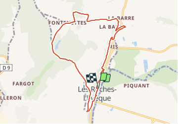
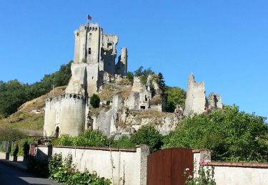
Tocht Stappen van 8,8 km beschikbaar op Centre-Val de Loire, Loir-et-Cher, Les Roches-l'Évêque. Deze tocht wordt voorgesteld door guydu41.

Beschrijving

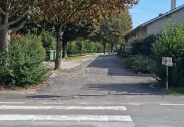
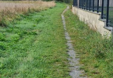
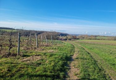
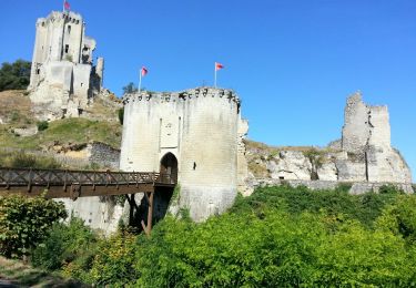
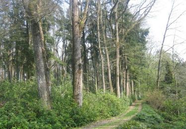
Très beau circuit qui suit en grande partie celui proposé par la commune . Les chemins et sentiers dans la commune longent le coteau truffé de caves et d'habitations troglodytes dont beaucoup sont abandonnées. Beaucoup de points de vue sur la vallée du Loir. Note importante : Le retour dans le village emprunte un sentier creux qui descend et se termine par une barrière (tube métallique) qu'il faut enjamber (≈ 75 cm de haut).

Hoogteprofiel

Foto's

31 fotos in totaal. Klik op een foto om ze allemaal in de galerij weer te geven.

Plaatsbepaling

Land:
France
Regio :
Centre-Val de Loire
Departement/Provincie :
Loir-et-Cher
Gemeente :
Les Roches-l'Évêque
Locatie:
Unknown
Vertrek:(UTM)
342081 ; 5293750 (31T) N.

Wandeltochten in de omgeving

Tocht Stappen Mazangé - Bonaventure - Moulin de la Loupe - Photo
Stappen
guydu41

Stappen

Medium
Mazangé, Centre-Val de Loire, Loir-et-Cher, France
8,3 km | 9,9 km-effort
2h 15min
Ja
Tocht Stappen Lunay - Château de la Mézière - Asnières  - Photo
Stappen
guydu41

Stappen

Medium
Lunay, Centre-Val de Loire, Loir-et-Cher, France
7,4 km | 8,5 km-effort
1h 56min
Ja
Tocht Stappen Saint-Rimay - Saint-Rimay - Photo
Stappen
guydu41

Stappen

Medium
Saint-Rimay, Centre-Val de Loire, Loir-et-Cher, France
11,3 km | 14,2 km-effort
3h 14min
Ja
Tocht Stappen Houssay - Houssay  - Photo
Stappen
guydu41

Stappen

Medium
Houssay, Centre-Val de Loire, Loir-et-Cher, France
11,5 km | 14,3 km-effort
2h 36min
Ja
Tocht Stappen Lunay - Lunay - Photo
Stappen
guydu41

Stappen

Medium
Lunay, Centre-Val de Loire, Loir-et-Cher, France
9,2 km | 11,1 km-effort
2h 30min
Ja
Tocht Stappen Houssay - Circuit Promenades et Randonnées (PR)
Stappen
guydu41

Stappen

Gemakkelijk
Houssay, Centre-Val de Loire, Loir-et-Cher, France
12,4 km | 14,8 km-effort
2h 48min
Ja
Tocht Stappen  - Lavardin - Vallée du Loir - 2015 08 22 - Photo
Stappen
Orcal37

Stappen

Medium
, Centre-Val de Loire, Loir-et-Cher, France
25 km | 31 km-effort
6h 0min
Ja
Tocht Mountainbike Fontaine-les-Coteaux - VTT autour de Fontaine-les-Coteaux - Photo
Mountainbike
tracegps

Mountainbike

Moeilijk
Fontaine-les-Coteaux, Centre-Val de Loire, Loir-et-Cher, France
50 km | 59 km-effort
3h 0min
Ja
Tocht Stappen  - Lavardin - 3.9km 1h00 - 2018 01 14 - Photo
Stappen
Orcal37

Stappen

Heel gemakkelijk
, Centre-Val de Loire, Loir-et-Cher, France
3,9 km | 4,9 km-effort
1h 0min
Ja


Sluiten
Mijn abonnementen